
How GPS Works in 2026: The Satellites, Signals and Science Behind Every Map
Imagine leaving your home in the morning, opening Google Maps, and asking your phone to guide you to a restaurant on the other side of the city. Within seconds, a small blue dot appears on the screen. As you walk, it moves with you. When you turn left, it follows. If you take a wrong street, the application notices and calculates another route.
The experience feels almost effortless. There is no visible connection between your phone and the sky, no cable running between your device and a navigation centre, and no person watching your journey from a control room. Yet somewhere thousands of kilometres above Earth, several satellites are continuously sending signals that help your phone calculate where you are.
This is the remarkable technology behind the Global Positioning System, better known as GPS.
GPS has become so deeply embedded in modern life that it is easy to forget how extraordinary it is. It helps aircraft navigate across oceans, guides delivery drivers through unfamiliar neighbourhoods, supports emergency services, allows farmers to work with remarkable precision, and provides accurate timing for parts of global communications and financial infrastructure.
But GPS is not simply a collection of satellites showing people where they are. It is an enormous scientific system built around radio waves, orbital mechanics, atomic clocks, mathematics and Einstein's theory of relativity.
In 2026, the technology is also changing. New satellite generations, additional civilian signals, more capable smartphone receivers and increasingly sophisticated threats are reshaping how satellite navigation works.
Understanding GPS means understanding how a device on the ground can use signals travelling at the speed of light to calculate its position on a rotating planet.
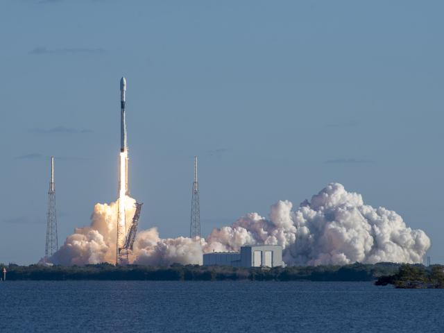
Key Takeaways
- GPS stands for Global Positioning System. It is a satellite-based system providing positioning, navigation and timing services worldwide.
- The United States operates GPS through the U.S. Space Force.
- GPS satellites orbit approximately 20,200 kilometres above Earth in medium Earth orbit.
- Each satellite carries highly accurate atomic clocks that help transmit precise timing information.
- A receiver normally needs signals from at least four satellites to calculate three-dimensional position and correct its own clock.
- GPS uses radio signals, including L1, L2 and L5, with different characteristics and applications.
- Einstein's theories of relativity are essential to GPS accuracy because satellite clocks run at a different rate from clocks on Earth.
- GPS accuracy depends on atmospheric conditions, satellite geometry, buildings, receiver quality and other factors.
- Modern smartphones can combine GPS with Galileo, GLONASS, BeiDou, Wi-Fi, cellular networks and motion sensors.
- Jamming and spoofing are growing concerns for aviation, maritime navigation and other critical applications.
- GPS remains important, but future navigation systems will increasingly combine satellites with independent positioning and timing technologies.
1. What Is GPS?
GPS is a satellite-based navigation system owned by the United States government. Its purpose is to provide three essential services:
- Positioning: Determining where something is located.
- Navigation: Helping something travel from one location to another.
- Timing: Providing highly accurate time information.
These three services are often abbreviated as PNT.
Although people commonly associate GPS with maps and driving directions, positioning is only one part of its importance.
For example, a shipping company might use GPS to monitor the location of containers. An aircraft can use satellite navigation to determine its position during a flight. A telecommunications network can use GPS timing to synchronise equipment operating in different locations.
Even systems that never display a map can depend on GPS-derived time.
GPS is not the same as Google Maps
One important distinction is that GPS and Google Maps are not the same technology.
GPS calculates geographical position using satellite signals. Google Maps is a mapping and navigation application that uses geographical databases, software, traffic information and location services.
Think of GPS as a person telling you your exact coordinates, while a digital map provides the names of streets, buildings, roads and destinations surrounding those coordinates.
A GPS receiver can calculate its position without an internet connection, provided it can receive sufficient satellite signals.
However, downloading maps, searching for businesses, receiving live traffic updates and calculating certain routes may require an internet connection.
This explains why a smartphone can sometimes show its current location while offline but cannot display detailed information about nearby restaurants.
Who operates GPS?
GPS is owned by the United States government and operated through the U.S. Space Force.
The Space Force maintains the satellite constellation and the ground infrastructure responsible for monitoring and controlling the system.
Civilian GPS signals are available worldwide without direct user fees. People do not need to register with the United States government or purchase a subscription simply to receive standard GPS signals.
The same basic service supports personal navigation, scientific research, commercial transportation and many other activities.
Source: GPS.gov — Global Positioning System.
2. The History of GPS: From Military Experiments to Everyday Navigation
GPS did not begin as a technology for smartphones or car navigation.
Its origins go back to the early years of the Space Age.
The Sputnik discovery
In 1957, the Soviet Union launched Sputnik 1, the first artificial satellite to orbit Earth.
American researchers studying the satellite discovered that its radio signal changed frequency as it moved relative to an observer on the ground.
This phenomenon is known as the Doppler effect.
The same principle explains why an ambulance siren appears to change pitch as it approaches and then moves away.
Scientists realised that if they could observe these frequency changes, they could calculate a satellite's position and movement.
Researchers later explored whether the reverse approach could work: instead of locating a satellite from Earth, could a receiver determine its own position by observing satellites?
That question helped establish the scientific foundation for satellite navigation.
The first GPS satellites
During the 1960s and early 1970s, the United States developed several satellite navigation experiments.
These included systems such as TRANSIT and TIMATION.
In 1973, the United States Department of Defense approved the development of a combined satellite navigation programme that became known as NAVSTAR GPS.
The first experimental NAVSTAR GPS satellite was launched in February 1978.
The system gradually expanded as more satellites entered orbit and engineers improved the technology.
By December 1993, GPS had achieved Initial Operational Capability.
In April 1995, the United States declared Full Operational Capability, meaning the system met its intended operational requirements.
When GPS became available to civilians
GPS was initially developed primarily for military purposes.
However, its potential civilian applications became increasingly important.
In 1983, following the destruction of Korean Air Lines Flight 007 after it entered Soviet airspace, the United States announced that GPS would eventually be made available for civilian aviation and other peaceful applications.
Another important moment came in May 2000.
At that time, the United States discontinued a feature called Selective Availability, which had deliberately reduced the positioning accuracy available to ordinary civilian receivers.
Its removal significantly improved civilian GPS accuracy.
This change helped accelerate the development of consumer navigation devices, vehicle tracking, smartphone navigation and location-based services.
Today, GPS is considered an essential global infrastructure rather than simply a military navigation project.
Sources: NASA — Global Positioning System History and GPS.gov — GPS Modernization.
3. The GPS Satellite Constellation: A Network Above Earth
The most visible part of GPS exists thousands of kilometres above the planet.
GPS relies on a constellation of satellites distributed around Earth so that receivers can observe several of them from almost any location.
How many GPS satellites are there?
The original GPS design established a baseline constellation of 24 operational satellites.
However, the system normally operates more satellites than this minimum.
GPS.gov explains that the United States has maintained approximately 31 operational GPS satellites for many years, although the exact number changes as satellites are launched, retired or placed in different operational roles.
Having additional satellites provides redundancy.
If one satellite requires maintenance or becomes unavailable, others can help maintain coverage.
The important point is that GPS does not depend on exactly 24 satellites being available at all times.
How high do GPS satellites orbit?
GPS satellites operate in medium Earth orbit, commonly abbreviated as MEO.
Their approximate orbital altitude is 20,200 kilometres above Earth's surface.
They travel around Earth at high speed and complete approximately two revolutions every 24 hours.
Their orbital period is close to 12 hours.
This altitude is a carefully selected compromise.
Satellites much closer to Earth would need to move through their orbits more frequently, requiring a larger constellation to provide worldwide coverage.
Satellites much farther away would create different challenges involving signal strength, orbital design and navigation performance.
Medium Earth orbit provides a practical arrangement for continuous global coverage.
Why are the satellites arranged in different orbital planes?
GPS satellites are organised into six orbital planes surrounding Earth.
These planes are distributed around the planet to ensure that receivers can observe satellites from different directions.
Imagine looking at the night sky from a particular location.
If every satellite followed exactly the same path, there would be long periods when only a limited number would be visible.
Distributing satellites across multiple orbital planes prevents this problem.
The arrangement is designed so that at least four GPS satellites are available from virtually anywhere on Earth under normal operating conditions.
More visible satellites generally provide additional measurement information and can improve positioning reliability.
What happens inside a GPS satellite?
A GPS satellite is a sophisticated spacecraft containing several important systems.
- Atomic clocks for extremely precise timekeeping.
- Radio transmitters for broadcasting navigation signals.
- Navigation computers for managing satellite data.
- Solar panels for generating electrical power.
- Antennas for communicating with ground stations.
- Thermal-control equipment to protect sensitive electronics.
- Propulsion systems for orbital adjustments.
The satellite continuously transmits information about its position, timing and operational condition.
Importantly, GPS satellites do not need to know where your phone is.
They broadcast signals outward. Your receiver performs the calculations needed to determine its own location.
This one-way arrangement is one reason GPS can support an enormous number of users simultaneously.
Source: GPS.gov — Space Segment.
4. Atomic Clocks: The Secret Behind GPS Accuracy
One of the most extraordinary components of GPS is something that has nothing to do with maps.
It is the atomic clock.
GPS depends on measuring how long radio signals take to travel from satellites to receivers.
Because radio signals travel at approximately the speed of light, even an extremely small timing error can create a substantial positioning error.
Why ordinary clocks are not accurate enough
Imagine that a satellite transmits a signal at an exact moment.
Your phone receives that signal a short time later.
If the signal travelled for 0.07 seconds, and its speed was approximately 300,000 kilometres per second, the receiver could calculate the distance using:
Distance = Speed × Time
However, the calculation only works if the timing information is sufficiently accurate.
Consider what happens if the timing measurement is wrong by just one-millionth of a second.
That is one microsecond.
Because light travels approximately 300 metres in one microsecond, the resulting distance error could be around 300 metres.
Even a timing error measured in billionths of a second matters.
How atomic clocks work
Atomic clocks use the extremely consistent natural frequencies associated with transitions between energy states in atoms.
Instead of relying on the mechanical movement of a clock's components, they use atomic behaviour as a highly stable reference.
GPS satellites carry multiple atomic clocks, commonly using rubidium or cesium technologies depending on the satellite generation.
These clocks provide the precision required for reliable navigation signals.
Ground control systems monitor satellite timing and provide corrections to maintain the accuracy of the navigation system.
Why GPS needs accurate time
GPS does not directly measure geographical coordinates.
It measures the arrival times of signals from different satellites.
From those measurements, the receiver calculates distances and uses geometry to determine its location.
Without accurate time, the calculated distances would be wrong.
This is why atomic clocks are not simply an optional improvement. They are fundamental to how GPS works.
Interestingly, GPS timing also supports applications outside navigation, including telecommunications synchronisation, scientific experiments and time distribution.
Source: NIST — How Do You Measure Your Location Using GPS?.
5. How GPS Signals Work: Understanding L1, L2 and L5
GPS satellites transmit radio signals using specific frequencies within the L-band portion of the radio spectrum.
These signals carry information that allows receivers to calculate satellite distances and positions.
The three particularly important GPS frequency bands are L1, L2 and L5.
L1: The traditional GPS signal
L1 is the best-known GPS frequency.
Its central frequency is 1575.42 MHz.
The original civilian GPS signal, known as L1 C/A, operates on this frequency.
C/A means Coarse/Acquisition.
It was designed to provide an accessible civilian navigation signal.
L1 is supported by an enormous range of existing navigation receivers, including smartphones, vehicle navigation systems and many portable GPS devices.
It remains a fundamental component of modern GPS.
L2: A second frequency for better measurements
The L2 frequency is 1227.60 MHz.
Historically, L2 was particularly associated with military GPS signals.
However, the GPS modernisation programme introduced a civilian signal known as L2C.
One important advantage of using two frequencies is the ability to estimate and correct ionospheric delays.
The ionosphere is a region of the upper atmosphere containing electrically charged particles.
These particles affect the way radio signals travel.
By comparing signals at different frequencies, a receiver can estimate some of this delay and improve positioning accuracy.
This is particularly useful for surveying and professional navigation.
L5: A signal designed for demanding applications
L5 operates at 1176.45 MHz.
It was developed to support demanding applications, particularly transportation and aviation.
L5 offers several technical advantages:
- Greater signal bandwidth.
- Higher transmitted power than the legacy L1 C/A signal.
- Modern signal structure.
- Improved resistance to certain forms of interference.
- Better performance when combined with other frequencies.
L5 occupies a radio band reserved for aeronautical radio navigation services.
Its design makes it especially useful for applications where reliable positioning is important.
What about L1C?
GPS modernisation also introduces L1C, a newer civilian signal operating on the L1 frequency.
It was designed to improve interoperability with international satellite navigation systems, including Galileo.
L1C is not identical to the older L1 C/A signal, even though both use the same central frequency.
This distinction matters because the frequency alone does not describe the complete signal structure.
Does every smartphone use all three frequencies?
No.
GPS hardware varies considerably between devices.
Some smartphones support multiple GPS frequencies, while others rely on more limited combinations.
A device must have compatible receiver hardware to benefit from additional signals.
Furthermore, the availability of a signal from a satellite does not automatically mean every application uses it.
One important technical qualification concerns the status of modernised signals: GPS.gov's published civil-signal documentation has historically classified L2C and L5 as pre-operational pending formal service declarations. Their availability and operational status should therefore be distinguished from their presence in compatible satellite hardware.
Sources: GPS.gov — New Civil Signals and GPS.gov — GPS Accuracy.
6. Trilateration: How GPS Calculates Your Position
This is the mathematical heart of GPS.
Your smartphone does not simply receive a message saying, "You are standing outside a restaurant."
Instead, it calculates its location by measuring distances to several satellites.
The mathematical process is called trilateration.
The difference between triangulation and trilateration
The two terms are often confused.
Triangulation determines a position using angles.
Trilateration determines a position using distances.
GPS primarily uses trilateration because its receiver calculates how far away each satellite is based on signal travel time.
Step 1: Measuring the first satellite
Imagine that your phone receives a signal from one satellite.
It calculates that the satellite is approximately 20,000 kilometres away.
Geometrically, your possible position could be anywhere on a sphere with a radius of 20,000 kilometres around that satellite.
One satellite alone cannot identify your exact location.
Step 2: Adding a second satellite
Now imagine that the phone receives another satellite signal.
The second measurement creates another sphere.
The two spheres intersect along a circle.
Your position must be somewhere on that circle.
The possibilities have become smaller, but they are still not precise enough.
Step 3: Adding a third satellite
A third satellite creates another sphere.
The intersection between the three spheres produces a much smaller number of possible locations.
In an idealised geometric model, there are generally two intersection points.
One may be physically implausible because it lies far away from Earth's surface.
The remaining point helps identify the receiver's location.
Step 4: Adding a fourth satellite
Real GPS receivers also have to correct for errors in their own internal clocks.
A smartphone does not contain an atomic clock comparable to those aboard GPS satellites.
Consequently, its clock introduces another unknown quantity into the calculation.
A fourth satellite provides another independent measurement.
The receiver can then solve for four unknowns:
- Latitude.
- Longitude.
- Altitude.
- Receiver clock offset.
This is why four satellites are normally required for a standard three-dimensional GPS position fix.
More satellites can provide additional information and help improve reliability.
Why your phone can calculate its position so quickly
Modern GPS receivers use highly specialised processors and mathematical algorithms.
They continuously compare incoming signals with expected signal patterns, calculate timing differences and estimate satellite positions using navigation data.
The receiver then solves a system of mathematical equations to determine the most likely position.
The calculation is repeated as new measurements arrive.
This is how your blue location marker can update continuously while you are walking or driving.
7. The Three Main Segments of GPS
GPS is not simply a network of satellites.
It is an interconnected system involving spacecraft, ground infrastructure and receivers.
These are known as the space segment, control segment and user segment.
The space segment
The space segment consists of the GPS satellites orbiting Earth.
Their responsibilities include:
- Broadcasting precise timing information.
- Transmitting orbital information.
- Sending satellite health information.
- Providing navigation signals to receivers.
The satellites operate continuously and are designed to provide global coverage.
The control segment
The control segment is the ground infrastructure responsible for monitoring and managing GPS.
It includes monitoring stations, control facilities and ground antennas.
These facilities track satellite behaviour and measure the accuracy of their signals.
They also monitor the satellite clocks and orbital positions.
If a satellite's predicted position needs correction, the control system can upload updated navigation information.
Ground controllers can also send commands to spacecraft and manage their operational condition.
Without this infrastructure, small errors in satellite clocks and orbital predictions would gradually undermine positioning accuracy.
The user segment
The user segment includes all the equipment that receives GPS signals.
Examples include:
- Smartphones.
- Vehicle navigation systems.
- Aircraft navigation equipment.
- Marine navigation devices.
- Agricultural machinery.
- Surveying instruments.
- Scientific receivers.
- Military navigation systems.
A GPS receiver does not need to transmit its location back to the satellites.
It simply receives the broadcast signals and calculates its own position.
This means GPS can provide navigation services to millions or billions of receivers without requiring a satellite to communicate individually with each user.
Source: GPS.gov — GPS System Overview.
8. Einstein's Relativity: Why GPS Needs Modern Physics
One of the most surprising facts about GPS is that it would not work accurately without Einstein's theories of relativity.
This is not an exaggeration.
GPS satellites experience different gravitational conditions and move at different speeds from clocks on Earth's surface.
Both effects influence how quickly their clocks run.
Special relativity: Moving clocks run slower
According to special relativity, a clock moving relative to an observer runs more slowly than a stationary clock in that observer's reference frame.
GPS satellites travel at several kilometres per second.
Their speed causes their atomic clocks to run approximately seven microseconds slower per day compared with clocks on Earth's surface, considering this effect alone.
General relativity: Weaker gravity makes clocks run faster
General relativity predicts that clocks in weaker gravitational fields run faster than clocks in stronger gravitational fields.
GPS satellites orbit approximately 20,200 kilometres above Earth.
The gravitational field at that altitude is weaker than the gravitational field experienced at Earth's surface.
This causes satellite clocks to run approximately 45 microseconds faster per day.
The combined effect
When both effects are combined:
45 − 7 = 38 microseconds per day.
GPS satellite clocks run approximately 38 microseconds faster per day than comparable clocks on Earth's surface.
That difference might sound insignificant.
However, remember that GPS uses timing to calculate distance.
A timing error of just one microsecond corresponds to approximately 300 metres of signal travel.
If the relativistic effects were ignored, GPS positioning would rapidly become unreliable.
Engineers account for these effects through clock-frequency adjustments and relativistic corrections in the navigation system.
Why this matters beyond GPS
The GPS system provides a practical example of how fundamental physics supports everyday technology.
Relativity is often introduced as an abstract subject involving black holes, high-speed spacecraft and distant galaxies.
Yet the same theory helps a driver find a nearby petrol station.
It is a reminder that discoveries in theoretical physics can eventually become essential components of ordinary infrastructure.
Source: NIST — Putting Einstein to the Test With the World's Most Accurate Clocks.
9. Why GPS Is Not Always Accurate
GPS can be remarkably precise, but it is not perfect.
You may have experienced this yourself.
Your phone might show you standing in the middle of a road when you are actually on the pavement.
A navigation application might suddenly move your position to the wrong side of a building.
These problems can happen even when the satellites are functioning normally.
Atmospheric interference
GPS signals travel through Earth's atmosphere before reaching a receiver.
Two atmospheric regions are particularly important.
The ionosphere contains electrically charged particles that can change the speed and apparent travel time of radio signals.
The troposphere, the lowest region of the atmosphere, also introduces signal delays.
Weather conditions, atmospheric composition and other factors influence these delays.
Dual-frequency receivers can estimate and reduce much of the ionospheric error.
Multipath: When signals bounce off buildings
Multipath occurs when a satellite signal reaches a receiver through more than one path.
Imagine standing between tall buildings.
A satellite signal might travel directly toward your phone, but another part of the signal could reflect off a nearby glass building before reaching your phone.
The reflected signal travels a longer distance.
If the receiver interprets it as a direct signal, it can calculate an incorrect distance.
This is one reason GPS performance can deteriorate in dense cities.
Urban canyons
An urban canyon is a street surrounded by tall buildings.
These environments create several navigation challenges.
Buildings can block signals from satellites in certain directions.
Other signals may reflect off windows, walls and metal surfaces.
The receiver may therefore have fewer useful measurements and poorer satellite geometry.
This can make your location appear to jump between nearby streets.
Trees and indoor environments
Dense trees can weaken or obstruct satellite signals.
Indoor environments create even greater difficulties because roofs, walls and other materials can block the signals.
GPS is generally designed for outdoor positioning, not reliable room-level navigation.
Some buildings use additional positioning technologies to improve indoor accuracy.
Satellite geometry
Even if a receiver can detect four satellites, their positions in the sky matter.
Imagine four satellites clustered closely together in one part of the sky.
Their measurements provide less useful geometric separation than four satellites spread across different directions.
This effect is known as Geometric Dilution of Precision, or GDOP.
A good satellite arrangement generally produces a more reliable position estimate.
How accurate is GPS in 2026?
Under open-sky conditions, ordinary GPS-enabled smartphones are typically accurate to approximately 4.9 metres or better in many situations.
However, this is not a guarantee for every device or environment.
Professional receivers can achieve significantly better results.
With dual-frequency measurements, carrier-phase processing and appropriate correction systems, high-end surveying equipment can reach centimetre-level real-time accuracy.
Long-term scientific measurements can achieve millimetre-level precision under specialised conditions.
It is important to distinguish between satellite signal accuracy and the final accuracy of a receiver.
A satellite can transmit an exceptionally accurate signal while a phone still calculates an imperfect position because of surrounding buildings or atmospheric interference.
Source: GPS.gov — GPS Accuracy.
10. Assisted GPS: How Your Smartphone Finds You Faster
Have you ever opened a navigation application in a city and noticed that your location appeared almost immediately?
Traditional GPS receivers sometimes need time to acquire satellite signals and download the necessary navigation information.
Smartphones use additional techniques to speed up this process.
One of them is Assisted GPS, commonly called A-GPS.
How assisted GPS works
A-GPS uses information supplied through internet or mobile networks to help a GPS receiver determine its location more quickly.
Depending on the implementation, assistance data can include:
- Approximate satellite orbital information.
- Satellite timing information.
- Satellite visibility predictions.
- Approximate device location.
- Network-derived timing assistance.
This can reduce the time required for the receiver to obtain a useful satellite fix.
Does A-GPS replace satellites?
No.
Assisted GPS supports the satellite receiver rather than replacing it.
The actual GPS position calculation still relies on satellite measurements when a satellite-based fix is being obtained.
A smartphone may also calculate an approximate location using cellular networks or Wi-Fi when satellite reception is poor.
Wi-Fi and cellular positioning
Wi-Fi positioning uses information about nearby wireless access points.
Cellular positioning uses signals and network information associated with mobile phone towers.
These techniques can help determine approximate location, especially indoors or in areas where GPS signals are weak.
Modern smartphones may combine these sources with accelerometers, gyroscopes and other sensors.
For example, motion sensors can help estimate how a phone is moving between reliable satellite measurements.
Google describes this broader approach as Location Accuracy on compatible Android devices.
The result is a hybrid positioning system rather than a simple GPS-only calculation.
Sources: Google Android Help — Location Accuracy and Apple — Location Services and Privacy.
11. GPS vs Galileo, GLONASS and BeiDou
GPS is not the only satellite navigation system operating in 2026.
Several countries and international organisations have developed their own global navigation satellite systems.
The general term for these systems is GNSS, meaning Global Navigation Satellite System.
The major global systems are GPS, Galileo, GLONASS and BeiDou.
GPS: United States
GPS is owned by the United States government and operated by the U.S. Space Force.
It is the oldest fully operational global satellite navigation system among the modern systems.
It provides civilian and military positioning and timing services worldwide.
Galileo: European Union
Galileo is the European Union's independent global satellite navigation system.
Its operational services began in December 2016.
The baseline constellation consists of 24 nominal satellites distributed across three orbital planes, with additional satellites supporting the system.
Galileo is designed to provide highly accurate positioning and is interoperable with GPS.
It also offers additional services, including a High Accuracy Service and Search and Rescue capabilities.
GLONASS: Russia
GLONASS is Russia's global satellite navigation system.
Its name is derived from the Russian phrase for Global Navigation Satellite System.
It provides worldwide positioning, navigation and timing services.
GLONASS is particularly important because compatible receivers can combine its measurements with GPS and other constellations.
BeiDou: China
BeiDou is China's global satellite navigation system.
It developed from earlier regional navigation capabilities into a worldwide service.
BeiDou supports positioning, navigation and timing, along with additional communication-related services in certain applications.
Its constellation uses a combination of different orbital configurations.
Why smartphones use multiple systems
Many modern smartphones are compatible with several GNSS constellations.
This means a device may receive GPS, Galileo, GLONASS and BeiDou signals simultaneously.
Why is this useful?
Imagine navigating through a street surrounded by tall buildings.
GPS alone might provide a limited number of visible satellites.
Adding Galileo and BeiDou can increase the number of available measurements.
More satellites can improve coverage, geometry and positioning reliability.
However, additional satellites do not automatically guarantee better accuracy.
Receiver quality, atmospheric conditions, interference and the quality of the signals remain important.
Comparing the main global systems
- GPS: United States; global positioning and timing.
- Galileo: European Union; independent global navigation.
- GLONASS: Russia; global positioning and timing.
- BeiDou: China; global navigation and additional services.
Other systems include Japan's QZSS and India's NavIC, which provide regional navigation capabilities and complement wider GNSS services.
Sources: GPS.gov — Other Global Navigation Satellite Systems and European Union Agency for the Space Programme — Galileo.
12. How GPS Is Used in 2026
GPS has developed far beyond its original military navigation purpose.
Its applications now extend across transportation, agriculture, scientific research, telecommunications and everyday consumer technology.


Smartphones and personal navigation
Smartphones are probably the most familiar GPS receivers.
Applications such as Google Maps, Apple Maps and other navigation services use location information to help people:
- Find nearby destinations.
- Navigate unfamiliar streets.
- Share their location.
- Record walking and cycling routes.
- Find lost devices.
- Track journeys.
These applications often combine GNSS with internet-based information and device sensors.
The map itself is not created by GPS. GPS supplies geographical measurements that mapping software can use.
Cars and transportation
Modern vehicles use satellite navigation for route guidance, location services and fleet management.
Commercial transport companies can monitor delivery vehicles and optimise routes.
Some advanced driver-assistance systems also use positioning information alongside cameras, radar, lidar and other sensors.
However, GPS alone is not sufficient for autonomous driving.
A vehicle must also understand nearby objects, road markings, traffic signals and changing road conditions.
Aviation
Aircraft use satellite navigation to determine their position and support flight procedures.
GPS and other GNSS technologies help pilots navigate long-distance routes and perform certain approaches to airports.
Aviation receivers must meet demanding safety and reliability requirements.
Systems such as the Wide Area Augmentation System in the United States provide additional corrections and integrity information.
Aircraft do not simply depend on an ordinary smartphone GPS receiver.
They use certified navigation equipment and procedures designed for aviation.
Agriculture and precision farming
GPS has transformed modern farming.
Tractors equipped with precision navigation can follow carefully planned routes across agricultural fields.
This allows farmers to:
- Reduce unnecessary overlap between passes.
- Improve planting accuracy.
- Apply fertiliser more precisely.
- Map field boundaries.
- Monitor crop conditions.
- Record harvesting operations.
With high-accuracy correction systems, agricultural machinery can follow paths with centimetre-level precision.
This can reduce wasted fuel, materials and working time.
Scientific research
Researchers use GPS to study the physical behaviour of Earth.
For example, high-precision GNSS receivers can measure movements of the Earth's crust.
Scientists can monitor tectonic plate movement, volcanic deformation and changes in glaciers.
GPS also contributes to atmospheric research.
Measurements of how satellite signals travel through the atmosphere can provide useful information about atmospheric conditions.
Emergency services
Emergency responders use location technology to find people who need assistance.
GPS can help rescue teams navigate remote environments, locate vehicles and coordinate operations.
Search-and-rescue systems can also use satellite communication and positioning technologies to support emergency response.
Telecommunications and financial infrastructure
GPS timing is particularly important in infrastructure that needs synchronised clocks.
Telecommunications networks use precise timing to coordinate their equipment.
Financial systems also rely on accurate timestamps for certain operations, auditing and transaction records.
Power infrastructure can use GPS-derived timing for monitoring and synchronisation.
These applications demonstrate that GPS is not merely about finding locations.
It is also an important source of time information.
13. GPS Jamming and Spoofing: Growing Navigation Threats
Although GPS is extremely useful, its signals have an important weakness.
By the time they reach Earth, satellite signals are relatively weak.
This makes them vulnerable to certain forms of radio interference.
Two particularly important threats are jamming and spoofing.
What is GPS jamming?
Jamming occurs when radio interference prevents a receiver from correctly detecting legitimate GPS signals.
A jammer transmits interfering energy within or near the frequencies used by satellite navigation systems.
If the interference is sufficiently strong, the receiver may lose its ability to calculate a reliable position.
Possible symptoms include:
- Loss of satellite reception.
- Navigation errors.
- Unstable location readings.
- Failure to obtain a position fix.
- Disruption of systems relying on GNSS timing.
Jamming can affect civilian and military receivers.
What is GPS spoofing?
Spoofing is different.
Instead of simply overwhelming the receiver with interference, a spoofing source transmits misleading signals that imitate legitimate satellite signals.
A receiver may accept the false information and calculate an incorrect position or time.
This is particularly concerning because the device may continue displaying a seemingly valid location.
A navigation system that loses its satellite signal may alert the user.
A system that accepts a convincing false signal may be more difficult to detect.
Why are aviation and maritime systems concerned?
Aircraft and ships often operate in environments where accurate navigation is essential.
GNSS interference can affect navigation equipment, flight planning and other systems that depend on satellite information.
The Federal Aviation Administration maintains guidance for pilots and operators dealing with GNSS jamming and spoofing.
Aviation operators may use independent navigation systems and established procedures to identify and manage interference.
How can GPS become more resilient?
Several technologies can improve resilience:
- Multi-constellation receivers.
- Multi-frequency signal processing.
- Signal authentication where supported.
- Inertial navigation systems.
- Alternative radio-navigation systems.
- Independent timing references.
- Improved interference detection.
Using several satellite constellations helps because a receiver is no longer relying on a single navigation system.
However, multiple constellations are not a complete solution. Many systems operate in nearby frequency bands and can be affected by sufficiently powerful interference.
It is also important to recognise that satellite signal authentication and anti-jamming are different capabilities.
Authentication helps a receiver assess whether navigation information is genuine. Anti-jamming technologies aim to preserve signal reception in the presence of interference.
Sources: FAA — GNSS Interference Resource Guide and GPS.gov — GPS Accuracy.
14. GPS and Privacy: What Does Your Phone Know About You?
GPS itself does not automatically know who you are or record every journey you make.
The satellite broadcasts are one-way.
Your phone receives the signals and calculates its position locally.
However, applications and online services may collect and store location information when you grant them permission.
This creates an important distinction between GPS technology and the privacy practices of the companies and applications using location data.
How location data can be collected
A smartphone application may obtain location information through:
- GPS and other satellite navigation systems.
- Wi-Fi positioning.
- Cellular network information.
- Bluetooth-based positioning.
- Device sensors and related location services.
Depending on the application and its permissions, location information may be used for navigation, weather forecasts, advertising, delivery services or other purposes.
Some applications may collect location data even when their main function does not obviously require it.
Why location history is sensitive
A collection of location records can reveal patterns about someone's daily life.
For example, repeated visits to the same location can suggest where someone lives or works.
Frequent visits to particular establishments can reveal personal interests or routines.
When combined with other information, location records can become surprisingly detailed.
How to protect your location privacy
There are several practical steps users can take:
- Review location permissions for installed applications.
- Give applications access only when necessary.
- Prefer approximate location when precise positioning is not required.
- Check whether an application can access location in the background.
- Review location-sharing settings.
- Remove applications that request unnecessary permissions.
- Understand the privacy policies of services that store location histories.
Turning off an application's location permission does not necessarily disable every possible location-related service on the phone.
Different devices use different location technologies, and settings can vary by operating system.
The key lesson is that GPS signals and location-data collection are separate issues.
GPS provides positioning information. Applications and services determine how that information is used and whether it is transmitted or stored.
Sources: Apple — About Privacy and Location Services and Google — Manage Android Location Settings.
15. The Future of GPS: What Could Change After 2026?
GPS has been operating for decades, but the technology continues to evolve.
Modernisation involves more than launching new satellites.
It includes improvements to satellite clocks, radio signals, ground control systems, receiver hardware and the technologies that protect navigation services.
GPS III and the next generation
GPS III satellites represent a major modernisation of the constellation.
They provide improved capabilities compared with earlier generations, including improved signal performance and additional modernised services.
In April 2026, the U.S. Space Force announced the successful delivery of GPS III-8, also identified as Space Vehicle 10, into orbit.
The spacecraft includes a new space-qualified atomic clock and other technological demonstrations.
However, delivery into orbit and becoming fully operational are not necessarily the same event.
A newly launched satellite must undergo appropriate checkout and operational procedures before it can be treated as an available operational navigation resource.
More advanced civilian signals
L2C, L5 and L1C are important parts of the GPS modernisation programme.
These signals are intended to improve positioning performance, support demanding applications and increase interoperability with other GNSS systems.
As compatible satellites and receivers become more widespread, civilian users should benefit from additional measurement options.
The precise benefits will depend on the satellite constellation, receiver capabilities and operational status of individual signals.
Better smartphone positioning
Smartphones are likely to continue improving their positioning capabilities.
Future devices may combine:
- Multiple GNSS constellations.
- Multiple satellite frequencies.
- Improved antenna designs.
- Better signal-processing algorithms.
- Advanced motion sensors.
- More sophisticated correction services.
The goal is not simply to make the blue dot more accurate in an open field.
It is to improve performance in difficult environments such as dense cities, underground transport stations and partially covered locations.
High-accuracy positioning for ordinary users
Centimetre-level positioning was once primarily associated with specialist surveying equipment.
Today, advanced GNSS receivers and correction services make this level of precision increasingly accessible to commercial applications.
Potential uses include automated agriculture, construction, robotics, infrastructure monitoring and autonomous machinery.
However, high accuracy usually requires more than an ordinary GPS signal.
Receivers may need additional correction information, dual-frequency measurements and sophisticated processing.
Alternative positioning systems
A major lesson from recent interference incidents is that critical infrastructure should not depend on a single source of positioning or timing.
Future systems are therefore likely to combine satellite navigation with complementary technologies.
These may include:
- Inertial navigation.
- Terrestrial radio-navigation systems.
- Fibre-optic timing distribution.
- Network-based positioning.
- Local positioning infrastructure.
- Alternative satellite navigation services.
The idea is to create systems that can continue functioning even if one source becomes unreliable.
GPS and artificial intelligence
Artificial intelligence may also improve the way navigation systems interpret positioning information.
For example, software could combine satellite measurements with road maps, camera information, vehicle sensors and historical movement patterns.
This may help identify implausible position readings and improve navigation in complicated environments.
However, AI does not eliminate the need for accurate underlying measurements.
If a receiver is being fed misleading satellite information, the system still needs independent evidence to recognise the problem.
What is known and what remains uncertain?
What is already established:
- GPS will continue to be modernised.
- Newer satellites provide improved capabilities.
- Multiple GNSS constellations are increasingly important.
- Dual-frequency positioning supports better atmospheric correction.
- Navigation resilience is receiving greater attention.
- High-precision positioning is becoming more accessible.
What remains uncertain:
- The exact timetable for full deployment of all modernised GPS signals.
- How quickly new satellite generations will replace older spacecraft.
- How affordable centimetre-level positioning will become for ordinary consumers.
- How effectively future receivers will resist sophisticated spoofing.
- Which alternative positioning technologies will become widespread.
GPS is not approaching an immediate technological replacement. Instead, it is evolving into a more complex navigation environment in which several independent systems work together.
Sources: U.S. Space Force — GPS III-8 Delivery, April 2026 and GPS.gov — GPS Modernization.
16. Why GPS Is One of the Most Important Technologies of Modern Life
GPS is a particularly interesting example of technology that has become almost invisible through everyday use.
Most people do not think about orbital mechanics when opening a navigation application.
They do not consider atomic clocks when checking their estimated arrival time.
They rarely think about atmospheric interference when watching their location move along a digital road.
Yet all these scientific and engineering systems work together to make that simple experience possible.
GPS connects space technology with everyday infrastructure.
It combines the physics of radio waves, the mathematics of trilateration, the precision of atomic clocks and the engineering of spacecraft operating thousands of kilometres above Earth.
Its importance is also much greater than personal navigation.
Modern transport, agriculture, telecommunications, emergency response and scientific research all benefit from satellite positioning and timing.
As the technology develops, GPS will increasingly operate alongside Galileo, GLONASS, BeiDou and other positioning systems.
The future of navigation is therefore unlikely to depend on one constellation alone.
It will depend on combining accurate satellite signals with independent technologies, stronger security and increasingly intelligent receivers.
The next time a blue dot appears on your phone, remember what is happening behind the screen.
A device in your hand is measuring the travel time of radio signals sent by satellites moving through space, correcting for differences in time and gravity, and solving mathematical equations to estimate your position on Earth.
Something that looks like a simple map is actually one of the most impressive applications of modern physics and engineering.
Frequently Asked Questions About GPS
1. What does GPS stand for?
GPS stands for Global Positioning System. It is a satellite-based navigation system owned by the United States government that provides positioning, navigation and timing services worldwide.
2. How does GPS work in simple terms?
GPS satellites continuously broadcast signals containing precise timing and orbital information. Your receiver measures when those signals arrive and calculates its distance from several satellites. It combines the measurements to determine its location.
3. How many satellites are needed for GPS?
A standard three-dimensional GPS position normally requires signals from at least four satellites. The additional measurement allows the receiver to estimate its own clock error as well as latitude, longitude and altitude.
4. How high are GPS satellites above Earth?
GPS satellites orbit at approximately 20,200 kilometres above Earth's surface. They operate in medium Earth orbit and complete approximately two revolutions around Earth every day.
5. Why do GPS satellites need atomic clocks?
GPS calculates distances by measuring how long radio signals take to travel from satellites to receivers. Atomic clocks provide extremely accurate timing references. Without them, small timing errors would create substantial positioning errors.
6. Does GPS need an internet connection?
No. A GPS receiver can calculate its location using satellite signals without an internet connection. However, applications may require internet access to download maps, search for destinations, retrieve traffic information or receive assistance data.
7. What is the difference between GPS and Google Maps?
GPS is a satellite navigation system that calculates geographical position. Google Maps is a mapping and navigation application that uses location information alongside road maps, business listings, routing software and traffic data.
8. What are L1, L2 and L5 in GPS?
They are GPS radio-frequency bands. L1 operates at 1575.42 MHz, L2 at 1227.60 MHz and L5 at 1176.45 MHz. They support different navigation signals and offer different technical capabilities.
9. What is GPS trilateration?
Trilateration is the mathematical process of calculating a position using distances from several known reference points. GPS receivers use the measured distances to satellites to determine their geographical position.
10. Why does GPS sometimes show the wrong location?
GPS accuracy can be affected by blocked signals, atmospheric delays, reflections from buildings, poor satellite geometry and receiver quality. Mapping errors can also make an otherwise accurate position appear incorrect.
11. Why does GPS work poorly inside buildings?
Satellite signals are relatively weak by the time they reach Earth. Roofs, walls and other construction materials can weaken or block these signals. Indoor positioning may therefore require Wi-Fi, Bluetooth or other technologies.
12. What is assisted GPS?
Assisted GPS uses information from mobile networks or internet services to help a receiver acquire satellite signals more quickly. It can reduce the time needed to obtain a GPS position fix, particularly on smartphones.
13. Is GPS more accurate than Galileo?
Neither system is universally more accurate in every situation. Both provide advanced positioning services. Actual performance depends on the receiver, signal quality, satellite geometry, atmospheric conditions and available corrections. Compatible receivers can combine both systems.
14. What is the difference between GPS and GLONASS?
GPS is operated by the United States, while GLONASS is operated by Russia. Both provide global satellite navigation services, but they use different satellite constellations and signal structures.
15. What is BeiDou?
BeiDou is China's global satellite navigation system. It provides positioning, navigation and timing services and supports additional capabilities in certain applications. Modern receivers can combine BeiDou signals with GPS and other GNSS systems.
16. Can GPS work without a SIM card?
Yes. A device with compatible GPS hardware can receive satellite signals without a SIM card. However, some assisted positioning services and online mapping features may not work without a network connection.
17. What is GPS jamming?
GPS jamming occurs when radio interference prevents a receiver from detecting legitimate satellite signals reliably. It can cause navigation devices to lose their position fixes or experience timing disruptions.
18. What is GPS spoofing?
GPS spoofing involves transmitting false or misleading navigation signals that imitate legitimate satellite broadcasts. A receiver may calculate an incorrect location or time if it accepts the false signals.
19. Can someone track me through GPS?
GPS satellites themselves do not automatically track individual receivers because the normal navigation signals are one-way broadcasts. However, smartphone applications and online services may collect location information when users grant permission or enable location-sharing features.
20. Is GPS free to use in 2026?
Yes. The standard civilian GPS service is provided worldwide without direct user fees. However, individual navigation applications, subscription-based correction services and specialised equipment may involve costs.
21. Can GPS work during bad weather?
Generally, yes. GPS signals can pass through ordinary weather conditions, including rain and clouds. However, severe atmospheric conditions and other sources of interference can affect signal quality and positioning accuracy.
22. Why does GPS need four satellites instead of three?
Three satellite measurements can theoretically determine a three-dimensional position if the receiver's clock is already accurate enough. However, ordinary GPS receivers have clock errors. A fourth satellite provides the additional measurement needed to solve for that clock offset.
23. Will GPS be replaced by a newer technology?
GPS is not expected to disappear in the foreseeable future. Instead, it is being modernised and increasingly combined with other satellite navigation systems and complementary technologies such as inertial navigation and terrestrial positioning.
24. Can GPS provide centimetre-level accuracy?
Yes, specialised receivers can achieve centimetre-level positioning using techniques such as dual-frequency measurements, carrier-phase processing and correction services. Ordinary smartphone GPS generally provides metre-level rather than centimetre-level accuracy.
25. Why is GPS important for telecommunications?
Telecommunications infrastructure often needs accurate synchronisation between equipment operating in different locations. GPS provides precise timing references that can help networks coordinate their operations and maintain reliable communications.
Sources and Further Reading
The following sources provide official technical information, historical background and scientific explanations used in this article.
- GPS.gov — Global Positioning System
https://www.gps.gov/gps - GPS.gov — Space Segment
https://www.gps.gov/space-segment - GPS.gov — GPS Accuracy
https://www.gps.gov/gps-accuracy - GPS.gov — New Civil Signals
https://www.gps.gov/new-civil-signals - NASA — Global Positioning System History
https://www.nasa.gov/general/global-positioning-system-history/ - NASA — GPS and Space Communications
https://www.nasa.gov/directorates/somd/space-communications-navigation-program/gps/ - NIST — How Do You Measure Your Location Using GPS?
https://www.nist.gov/how-do-you-measure-it/how-do-you-measure-your-location-using-gps - NIST — Putting Einstein to the Test With the World's Most Accurate Clocks
https://www.nist.gov/blogs/taking-measure/putting-einstein-test-worlds-most-accurate-clocks - Federal Aviation Administration — How GPS Works
https://www.faa.gov/about/office_org/headquarters_offices/ato/service_units/techops/navservices/gnss/gps/howitworks - Federal Aviation Administration — GNSS Interference Resource Guide
https://www.faa.gov/about/office_org/headquarters_offices/avs/offices/afx/afs/afs400/afs410/GNSS - U.S. Space Force — GPS III-8 Satellite Delivery, April 2026
https://www.ssc.spaceforce.mil/Newsroom/Article/4465444/us-space-force-delivers-final-gps-iii-to-orbit-advancing-its-most-resilient-con - European Union Agency for the Space Programme — Galileo
https://www.euspa.europa.eu/eu-space-programme/galileo - GPS.gov — Other Global Navigation Satellite Systems
https://www.gps.gov/other-global-navigation-satellite-systems-gnss - Apple — Privacy and Location Services
https://support.apple.com/en-us/102515 - Google Android Help — Manage Location Settings
https://support.google.com/android/answer/3467281
The conversation
Post a Comment