Artemis II's Hidden Effect on Earth's GPS: How Rocket Launches Disturb the Ionosphere and Could Affect Navigation
Imagine driving along a perfectly familiar road when the blue navigation arrow on your phone suddenly moves several metres away from your actual position.
You have not taken a wrong turn. Your phone has not lost its internet connection. The road has not changed. Yet the satellite signals helping your device calculate its position have travelled through an invisible region of Earth's atmosphere that has recently been disturbed.
Now imagine a drone following an automated flight route, an agricultural tractor steering itself between rows of crops, or an autonomous vehicle calculating its position to within a few centimetres. For these technologies, even a temporary positioning error can become more than an inconvenience.
What could cause such a disturbance?
One surprising possibility comes from an activity that usually seems completely disconnected from everyday navigation: launching a rocket into space.
In April 2026, NASA's Artemis II mission sent four astronauts on a historic journey around the Moon. The mission attracted worldwide attention, but scientists subsequently identified another consequence of the flight. Its enormous rocket and subsequent engine burns produced unusual disturbances in Earth's ionosphere, the electrically charged region of the upper atmosphere through which satellite-navigation signals must travel.
Research from scientists at Taiwan's National Cheng Kung University attracted international attention in November 2026. The findings suggest that rocket launches and high-altitude engine operations can produce enormous atmospheric disturbances, potentially affecting the accuracy of satellite-based positioning.
The implications extend beyond space exploration. GPS supports transportation, agriculture, aviation, surveying, logistics, emergency services and increasingly autonomous machines.
However, an important distinction must be made from the beginning: researchers detected atmospheric disturbances using GPS measurements, but this does not establish that ordinary GPS users experienced a widespread outage or that autonomous vehicles actually malfunctioned.
The scientific question is more interesting than the headlines suggest. How can a rocket travelling towards the Moon influence a navigation signal travelling towards a car on Earth?
And what happens when launches become much more frequent?
1. Artemis II: The Moon Mission That Revealed an Unexpected Earth Problem
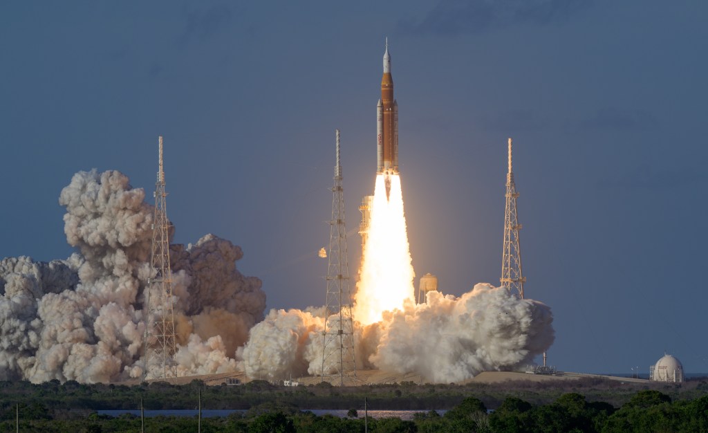
Artemis II was one of the most important human spaceflight missions of 2026.
Organised by NASA, the mission represented the first crewed flight of the Artemis programme and the first journey carrying astronauts towards the Moon since the Apollo era.
The spacecraft launched on April 1, 2026, from Kennedy Space Center in Florida.
Its crew consisted of:
- Reid Wiseman, mission commander.
- Victor Glover, pilot.
- Christina Koch, mission specialist.
- Jeremy Hansen, mission specialist representing the Canadian Space Agency.
The astronauts travelled aboard Orion, a spacecraft designed to carry humans beyond low Earth orbit.
The mission lasted approximately nine days, one hour and 32 minutes. The crew returned safely to Earth on April 10, 2026.
Artemis II was primarily designed to test spacecraft systems, demonstrate crewed deep-space operations and prepare for subsequent lunar exploration missions.
But its rocket also provided scientists with an unusual opportunity to study how large propulsion events influence the atmosphere.
Why the rocket was different
The Space Launch System, commonly called SLS, is a super-heavy-lift rocket.
It combines a large central core stage powered by liquid-fuel engines with two solid rocket boosters. Its upper-stage propulsion system subsequently performs important manoeuvres that help send Orion towards the Moon.
A rocket does not simply burn its engines once and disappear into space.
Different stages ignite, separate and sometimes restart. Each operation produces physical and chemical effects in the surrounding environment.
Most people associate these effects with flames, smoke, vibrations and noise.
Scientists, however, are interested in what happens much higher above the launch site, where the rocket interacts with the ionosphere.
The Artemis II research attracted particular attention because the mission produced multiple disturbances during different stages of its journey, rather than leaving scientists with only the familiar atmospheric signature of a launch.
NASA's official mission record can be consulted here:
2. What Is the Ionosphere, and Why Does It Matter?
To understand the discovery, it helps to imagine Earth surrounded by several invisible atmospheric layers.
The atmosphere is not simply a uniform blanket of air. Temperature, pressure, chemical composition and electrical properties change with altitude.
One particularly important region is the ionosphere.
According to NOAA, the ionosphere occupies the upper atmosphere, beginning at approximately 60 kilometres above Earth's surface and extending through several hundred kilometres of altitude. It contains electrically charged particles created primarily when solar ultraviolet and X-ray radiation interacts with atmospheric gases.
When sunlight supplies enough energy, atoms and molecules lose electrons. This process is called ionisation.
The resulting region contains free electrons and positively charged ions. Together, they form an electrically active environment known as plasma.
Unlike the air surrounding a person standing on a street, this plasma can strongly influence radio signals.
That is why the ionosphere is important for communications, scientific measurements and satellite navigation.
The atmosphere's invisible electrical layer
Think of the ionosphere as a constantly changing electrical landscape.
During daylight, solar radiation increases ionisation. At night, the density of charged particles changes as atmospheric processes gradually remove electrons and ions recombine.
Solar activity also influences its behaviour.
Solar flares, geomagnetic storms and changes in the solar wind can alter electron concentrations and create irregularities.
The ionosphere is therefore never perfectly static.
It behaves more like a changing ocean than a solid surface.
Sometimes its variations are gradual and predictable. At other times, disturbances develop quickly, producing conditions that affect the passage of radio waves.
Why a small atmospheric change can matter
A satellite-navigation receiver does not see the ionosphere directly.
It receives radio signals from satellites and uses their timing information to calculate distances.
If the signals experience unexpected delays while travelling through the atmosphere, the receiver may calculate those distances incorrectly.
The result can be a positioning error.
This is the essential connection between the upper atmosphere and the navigation systems used by people on the ground.
The ionosphere is not merely an interesting scientific region. It is part of the environment through which modern positioning technology operates.
NOAA explains the relationship in its official ionospheric resources:
NOAA: Understanding Total Electron Content.
3. How GPS Actually Works: A Race Against Time
GPS appears almost magical when viewed from the perspective of a smartphone.
Open a navigation application, wait a few seconds and a blue dot appears showing where you are.
But the technology relies on an extraordinarily precise measurement: time.
The Global Positioning System uses a constellation of satellites orbiting Earth at approximately 20,200 kilometres above the surface.
Each satellite continuously broadcasts information containing its position and extremely accurate timing data.
Your receiver listens for signals from multiple satellites and calculates how long each signal took to arrive.
Because radio waves travel at approximately the speed of light, the receiver can convert the travel time into an estimated distance.
This process is called pseudorange measurement.
Why four satellites are needed
Imagine standing somewhere on Earth while receiving signals from several satellites.
The first signal tells your receiver that you are approximately a certain distance from satellite A.
The second provides another distance.
The third adds another measurement.
Together, these measurements narrow down the possible location.
A fourth satellite is normally required to resolve the receiver's clock error and calculate a complete three-dimensional position and time solution.
The mathematical method behind this process is known as trilateration.
The receiver repeats these calculations continuously as the satellites move across the sky.
The US Federal Aviation Administration explains that the basic GPS service uses measurements from at least four satellites to determine location and time.
The problem with the journey through the atmosphere
There is an important complication.
GPS signals do not travel through empty space all the way to your phone.
They pass through the ionosphere before reaching the Earth's surface.
Charged particles affect the propagation of these radio signals.
The ionosphere can change their travel time, meaning that a receiver may interpret an atmospheric delay as a difference in distance.
Think of measuring the distance between two cities by timing a car journey.
If the car unexpectedly encounters a section of road where traffic slows down, the journey takes longer.
If you assume that the car travelled at its usual speed, your distance calculation will be wrong.
The ionosphere creates a comparable measurement problem, although the physical mechanism involves radio-wave propagation rather than road traffic.
Why a few billionths of a second matter
GPS signals travel at roughly 300,000 kilometres per second.
At that speed, even a tiny timing error corresponds to a meaningful distance.
A one-nanosecond timing difference represents approximately 30 centimetres of light-travel distance.
Several nanoseconds can therefore translate into metres of apparent range error.
The receiver must correct for atmospheric delays, satellite clock differences, orbital uncertainties and other sources of error.
When the ionosphere behaves differently from what the receiver expects, the correction becomes less accurate.
This is why disturbances in an atmospheric region hundreds of kilometres above the ground can influence a navigation device in someone's pocket.
Further reading: FAA: How GPS Works.
4. The November 2026 Discovery: Three Disturbances Associated With Artemis II
The central scientific development concerns a manuscript titled Rare Multiple Ionospheric Disturbances Observed During the Artemis-II Lunar Flyby Voyage.
The work was prepared by researchers including scientists from National Cheng Kung University in Taiwan.
The research attracted widespread news coverage on November 4 and 5, 2026. Its findings were based on measurements of total electron content collected during the mission.
The manuscript is available through the ESS Open Archive and as a research PDF. Its peer-review and final journal-publication status should be checked before describing it as a fully peer-reviewed paper.
How the researchers investigated the event
The researchers used observations from high-precision, ground-based GNSS receiver networks.
These receivers are not ordinary smartphone navigation devices.
Many are installed at carefully surveyed locations and continuously collect satellite signals. Scientists use their measurements to investigate small movements of Earth's crust, atmospheric conditions and other geophysical processes.
Because the signal travels through the ionosphere before reaching the receiver, its timing and phase contain information about the atmosphere.
By analysing the measurements, researchers can reconstruct changes in the total electron content along satellite-to-ground paths.
This allows them to identify unusual patterns associated with rocket launches and engine operations.
Three events, not just one
The research identified three separate disturbances associated with the Artemis II flight.
The first disturbance: launch and ascent.
The first event occurred during the initial launch on April 1, 2026.
As the rocket accelerated through the atmosphere, its passage generated pressure waves and atmospheric disturbances that propagated upwards.
These waves affected the ionosphere's structure and produced shock-acoustic and gravity-wave signatures in the measurements.
The second disturbance: the Apogee Raise Manoeuvre.
Approximately one hour and 48 minutes after liftoff, an upper-stage engine operation produced another significant disturbance.
This manoeuvre involved the Interim Cryogenic Propulsion Stage, or ICPS. Its engine operated for approximately 18 minutes.
The important detail is that the operation deposited energy directly into the ionospheric environment rather than relying only on waves travelling upwards from lower atmospheric altitudes.
The third disturbance: the translunar injection manoeuvre.
A further engine burn occurred approximately 25 hours after the original launch.
This operation helped place Orion on its trajectory towards the Moon.
The Orion orbital-manoeuvring engine operated for approximately five minutes and 50 seconds and was associated with another ionospheric disturbance.
The third disturbance was similar to the second, although weaker.
The repeated events are especially important.
A rocket launch can disturb the ionosphere through its movement and exhaust. However, Artemis II demonstrated why scientists must also examine what happens after the vehicle has left the launch pad.
The upper-stage and spacecraft burns can create additional disturbances long after the initial spectacle has ended.
How large were the disturbances?
The research describes disturbances extending across approximately 50 degrees of longitude over North America.
That corresponds to a geographical scale of more than 5,000 kilometres along the spacecraft's trajectory.
Some headlines call these features enormous holes in Earth's atmosphere.
That description is dramatic but potentially misleading.
There was no physical opening in the atmosphere. The researchers were observing changes in electron density and wave-like disturbances within an electrically charged region.
The scale refers to the geographical extent of the observed disturbance, not a hole through which air or atmospheric gases disappeared.
The ionosphere remained present. Its electrical characteristics changed temporarily.
5. How Rocket Exhaust Creates an Ionospheric Disturbance
There are several mechanisms through which rocket operations can disturb the ionosphere.
Two important categories involve chemical reactions between exhaust products and charged atmospheric particles, and pressure waves and atmospheric motion.
They can occur together, but they are not the same phenomenon.
The chemical mechanism: reducing free electrons
Rocket engines release enormous quantities of exhaust gases.
Depending on the engine and propellant, these gases can include water vapour, hydrogen-related compounds and other chemical products.
When exhaust is released at sufficiently high altitude, it enters an environment containing ionised oxygen and other charged particles.
Certain exhaust molecules can react with the existing ions.
These reactions can produce molecular ions that subsequently undergo recombination processes, reducing the number of free electrons.
In simple terms, the rocket injects chemicals into an environment whose electrical properties depend on the presence of charged particles.
The resulting chemistry can temporarily reduce electron density.
This creates what researchers describe as an ionospheric depletion or ionospheric hole.
It is not an empty space. It is a region where the number of free electrons has decreased compared with the surrounding ionosphere.
Why water vapour and hydrogen matter
One of the clearest historical examples occurred during NASA's Skylab launch in 1973.
Scientists observed a substantial decrease in ionospheric electron content following the Saturn V rocket's passage.
The research published in Science in 1975 connected the phenomenon to hydrogen and water vapour in the rocket's exhaust.
These substances accelerated chemical processes that removed electrons from the ionospheric plasma.
The Skylab observation established that human spaceflight could influence the ionosphere on a significant scale.
Artemis II therefore did not reveal an entirely new physical phenomenon.
Its significance lies in the unusual scale, repeated disturbances and the role of later propulsion operations within the ionosphere.
The shockwave mechanism
The second mechanism involves waves.
A rocket travelling at extremely high speed creates pressure disturbances in the atmosphere.
Its supersonic movement can generate shock waves that propagate through the surrounding air.
As these waves travel upwards, they can influence the density and distribution of charged particles in the ionosphere.
Some disturbances move outward in distinctive V-shaped patterns.
Others produce circular or wave-like structures.
Scientists can identify these patterns through changes in total electron content.
Research examining earlier rocket launches has documented shock-wave-related travelling ionospheric disturbances, demonstrating that this process is not unique to Artemis II.
Why the upper-stage burns were particularly interesting
The surprising lesson from Artemis II is that the most powerful launch phase does not necessarily create the strongest disturbance in the ionosphere.
The rocket's enormous initial thrust is only one part of the equation.
Where the engine operates, how long it burns, the exhaust composition, the surrounding atmospheric conditions and the trajectory all matter.
An engine firing directly inside the ionosphere can interact with the charged environment more directly than a powerful engine burning primarily below it.
The researchers reported that the later orbital manoeuvres produced significantly stronger disturbances than the initial ascent measurements, despite involving less total energy.
The manuscript explains that the concentrated energy input created local pressure bulges and shock fronts, producing disturbances that extended along the spacecraft's trajectory.
Importantly, the study also notes that chemical electron depletion is a separate aspect requiring additional investigation. It would therefore be inaccurate to describe every Artemis II disturbance as a chemically produced hole.
6. Why GPS Accuracy Can Change When the Ionosphere Is Disturbed
The relationship between electron density and GPS performance is well established.
NOAA identifies total electron content, or TEC, as an important parameter for understanding how the ionosphere affects satellite navigation.
TEC represents the total number of electrons along the path between a transmitter and a receiver.
It is measured in electrons per square metre, with one TEC unit representing 1016 electrons per square metre.
When TEC changes, the propagation delay experienced by a satellite signal changes too.
The receiver must account for this effect when calculating its position.
Why the delay is frequency-dependent
The ionosphere is a dispersive medium.
That means its effect on radio signals depends on their frequency.
At the frequencies used by satellite-navigation systems, the first-order ionospheric delay is approximately proportional to the electron content and inversely proportional to the square of the signal frequency.
This is why dual-frequency receivers are particularly useful.
They can compare signals at different frequencies and estimate the ionospheric contribution to the delay.
Single-frequency receivers usually depend on mathematical models and correction information to compensate for the expected ionospheric effect.
When conditions change unexpectedly, those corrections can become less effective.
From a small timing error to a positioning error
A GPS receiver calculates its position using several satellite measurements simultaneously.
If one or more signal paths experience unexpected delays, the calculated distances can become inaccurate.
The final positioning error depends on several factors:
- The amount of electron-density variation.
- The geometry of the satellites being tracked.
- The frequency and quality of the receiver.
- The receiver's correction system.
- Whether the disturbance affects one or several signal paths.
- The speed at which the atmospheric conditions change.
The error is not necessarily identical for every receiver under the same atmospheric conditions.
One device might continue working with a small change in accuracy, while a high-precision receiver could experience a more significant problem.
Could the error reach several metres?
November coverage of the Artemis II research described potential positioning errors of several metres.
This is a meaningful scale for technologies that depend on accurate lane-level or centimetre-level positioning.
However, the wording requires care.
The research used GNSS observations to detect and reconstruct ionospheric changes. The reported positioning implications should not be confused with a documented failure of consumer GPS devices or a measured accident involving an autonomous vehicle.
The research identifies a plausible navigation risk that deserves further testing.
It does not demonstrate that millions of phones suddenly displayed incorrect locations or that the entire GPS constellation was affected.
NOAA explains that severe ionospheric disturbances can produce much larger errors, sometimes reaching tens of metres or more, although those figures describe broader space-weather conditions rather than a measured Artemis II outcome.
7. Could Rocket Launches Affect Drones?

Drones are among the technologies that make the Artemis II discovery particularly interesting.
A modern drone can use satellite navigation to determine its location, follow a programmed route, return to its launch point and maintain a position in the air.
Many commercial and industrial drones use GPS alongside other GNSS constellations.
This is especially useful when the aircraft must operate over large areas or maintain a predictable route.
What happens if positioning becomes inaccurate?
Imagine a drone programmed to follow a straight line over an agricultural field.
Its navigation system continuously compares its estimated position with the planned flight path.
If the satellite-derived position suddenly shifts, the drone may calculate that it has moved away from the intended route.
Depending on its software and control architecture, it may attempt to correct its position.
If the error is large enough, the drone could deviate from the desired path.
Other potential consequences include:
- Reduced accuracy during aerial mapping.
- Incorrect geotagging of photographs.
- Errors in agricultural spraying routes.
- Inaccurate automated landing positions.
- Reduced reliability of return-to-home functions.
- Temporary loss of precise positioning.
However, the presence of an ionospheric disturbance does not automatically mean that a drone will become uncontrollable.
Modern systems can use inertial measurement units, barometers, magnetic sensors, optical-flow cameras and other positioning technologies.
These additional sensors help maintain flight stability when satellite navigation becomes less reliable.
Why agricultural drones deserve attention
Agricultural drones increasingly perform specialised tasks.
They can map fields, inspect crops, identify areas requiring attention and apply treatments with carefully controlled flight patterns.
A positioning error that would barely matter to someone recording a holiday video could become more important when the aircraft is following a precise spraying route.
For now, the Artemis II research does not establish that agricultural drones experienced operational problems.
It identifies a possible weakness that engineers and operators should consider when designing systems that depend heavily on satellite positioning.
8. Autonomous Vehicles: When a Few Metres Become a Safety Question
Autonomous vehicles have a different relationship with GPS than ordinary cars.
A conventional driver can see the road, recognise signs and correct a navigation mistake.
An autonomous vehicle must interpret its surroundings through a combination of sensors and software.
Satellite positioning is one important source of location information.
However, it is not the only one.
Why lane-level accuracy matters
A car travelling along a multi-lane motorway must understand not just which road it occupies but also which lane it is using.
For certain automated-driving applications, this requires highly accurate localisation.
A positioning error of several metres could be significant.
The vehicle might incorrectly estimate its position relative to a mapped lane, junction or road boundary.
Study co-author Charles Lin warned in November coverage that a positioning error of a couple of metres could be enough to influence an autonomous vehicle's lane decision.
That is a warning about a potential engineering problem, not a report that Artemis II caused vehicles to change lanes.
Why autonomous cars do not rely on GPS alone
A modern automated vehicle can combine several information sources:
- GNSS satellite positioning.
- Cameras that recognise road markings and objects.
- Radar that measures the distance and movement of surrounding objects.
- LiDAR systems that create detailed representations of the environment.
- Inertial sensors that estimate movement and rotation.
- Wheel-speed measurements.
- High-definition maps.
This approach is known as sensor fusion.
It allows the vehicle to compare different measurements instead of blindly trusting one source.
If the GPS position disagrees with the camera-based estimate or the vehicle's inertial measurements, the software can identify inconsistencies and adjust its confidence.
But sensor fusion is not a guarantee of perfect safety.
A system must correctly identify unreliable information, avoid overconfidence and know when to reduce speed, request human intervention or enter a safe operating condition.
The Artemis II findings reinforce an important principle: automated systems should be designed to recognise when satellite navigation becomes less reliable.
9. What About Commercial Aviation?
Aircraft depend on accurate positioning for navigation, route planning and certain approach procedures.
Satellite navigation has transformed aviation by allowing aircraft to follow routes and approaches that are more flexible than traditional ground-based navigation methods.
But aviation does not treat every GPS position as automatically trustworthy.
Systems such as the Wide Area Augmentation System, or WAAS, provide correction and integrity information to compatible GPS receivers.
Ground reference stations monitor satellite signals and help identify errors.
The system distributes correction information to improve accuracy and warn receivers when certain navigation information should not be trusted.
Could an ionospheric disturbance affect an aircraft?
In principle, yes.
Ionospheric changes can influence the timing and quality of GNSS signals received by aircraft.
However, the practical impact depends on the location, severity, duration and geometry of the disturbance.
Aviation navigation also includes established operational procedures, alternative navigation sources and safety monitoring.
There is no evidence that Artemis II caused an aviation accident or a widespread aircraft navigation failure.
The appropriate conclusion is that rocket-induced ionospheric disturbances deserve attention from aviation engineers and navigation-service providers, especially if future missions create similar effects more frequently.
More information:
10. The Agricultural GPS Connection
One of the less obvious consequences of satellite-navigation errors concerns farming.
Modern agriculture increasingly depends on precision positioning.
A tractor equipped with satellite guidance can follow planned rows across a field with remarkable consistency.
This technology helps farmers reduce overlap, manage planting distances, control equipment and use resources more efficiently.
Some precision-agriculture systems use Real-Time Kinematic positioning, commonly known as RTK.
RTK uses correction information from reference stations or networks to improve positioning accuracy, potentially reaching centimetre-level precision under suitable conditions.
Why precision farming is sensitive to positioning
Imagine a tractor planting seeds along parallel rows.
If its position estimate shifts, the guidance system may calculate the wrong path.
Depending on the size and duration of the error, this could lead to uneven spacing, overlapping passes or missed sections.
The same principle applies to fertiliser application, spraying and automated harvesting.
The problem is not limited to tractors.
Surveying equipment, construction machinery and other precision-guided systems also depend on reliable satellite positioning.
NOAA identifies farming, construction, surveying and other precision industries among the activities that benefit from high-precision GPS and GNSS services.
Is this a current agricultural threat?
There is no evidence that Artemis II damaged agricultural equipment or disrupted farming operations.
The disturbances were associated with the mission's flight and the atmospheric region above North America.
Their practical significance for agriculture elsewhere would depend on whether similar disturbances occur above relevant operating areas and whether they exceed the correction capability of the equipment.
Nevertheless, as autonomous agricultural machinery becomes more common, understanding atmospheric influences on navigation becomes increasingly valuable.
11. The Historical Evidence: Artemis II Was Not the First Rocket to Disturb the Ionosphere
The discovery becomes easier to understand when placed in historical context.
Scientists have known for decades that rocket launches can influence the upper atmosphere.
The Skylab discovery of 1973
NASA's Skylab launch in May 1973 produced one of the most famous examples.
Researchers detected a substantial reduction in ionospheric electron content following the Saturn V rocket's passage.
The disturbance was associated with chemical reactions involving the rocket's exhaust.
The findings were published in Science in January 1975.
This established an important scientific fact: human activity can create temporary changes in the ionosphere on a surprisingly large scale.
The Falcon 9 launch of 2017
A later example occurred during the launch of Taiwan's FORMOSAT-5 satellite aboard a SpaceX Falcon 9 rocket in August 2017.
Researchers observed large circular shock-acoustic waves in the ionosphere.
The waves spread across a substantial region of the western United States and Pacific area.
The study also identified a large-scale ionospheric plasma depletion associated with the rocket exhaust.
Importantly, the researchers concluded that the measured acoustic-wave amplitude had little impact on GPS navigation accuracy in that particular event.
This is a useful reminder that detecting an atmospheric disturbance does not automatically mean that navigation services will fail.
The Starship launch of 2023
Another important example came from SpaceX's Starship flight on November 18, 2023.
Researchers examined GNSS measurements following the flight and the subsequent explosions.
They identified large V-shaped ionospheric disturbances extending approximately 2,000 kilometres from the rocket trajectory.
The findings were published in Geophysical Research Letters in 2024.
What makes Artemis II different?
The Artemis II research stands out for three reasons.
First, it identified multiple disturbances associated with different stages of one mission.
Second, it highlighted the importance of upper-stage engine operations within the ionosphere.
Third, it raised questions about how repeated high-altitude burns during future lunar and interplanetary missions could influence satellite navigation.
The discovery does not mean that previous rockets were harmless.
It means that researchers are beginning to understand more clearly how complex mission profiles can produce different atmospheric effects.
12. How Scientists Are Monitoring These Invisible Disturbances
The ionosphere cannot be inspected like a cloud or photographed like a mountain.
Scientists must use instruments that can detect its electrical properties indirectly.
One particularly valuable tool is the GNSS receiver network.
Ground-based receiver networks
High-precision GPS stations continuously record signals from satellites.
When scientists compare observations from many stations, they can identify unusual changes in signal propagation.
The data can reveal variations in total electron content and help reconstruct the location and development of ionospheric disturbances.
This was central to the Artemis II investigation.
Total Electron Content maps
NOAA operates products that monitor ionospheric electron content.
Its Global Total Electron Content system, known as GloTEC, combines ground-based GNSS observations and space-based measurements to estimate the distribution of electrons throughout the ionosphere.
These maps help scientists and navigation users understand changing atmospheric conditions.
Monitoring scintillation
Another important phenomenon is ionospheric scintillation.
Scintillation occurs when small-scale irregularities in electron density rapidly modify radio signals.
It can produce changes in signal strength and phase.
Under severe conditions, a GPS receiver may lose its ability to maintain a reliable lock on a satellite signal.
Combining different observations
Scientists can combine:
- Ground-based GNSS measurements.
- Satellite observations.
- Radio-occultation measurements.
- Ionosondes.
- Atmospheric models.
- Solar and geomagnetic monitoring.
- Rocket trajectory and propulsion records.
Together, these tools help researchers separate rocket-related disturbances from natural variations caused by the Sun and Earth's atmosphere.
The more complete the dataset becomes, the better scientists can estimate when a launch might produce a significant disturbance.
13. What Engineers Can Do to Protect GPS and GNSS Systems
The answer is not to stop launching rockets.
Space exploration has enormous scientific, technological and economic value.
The challenge is to make spaceflight compatible with the increasingly important positioning infrastructure used on Earth.
Several engineering approaches can help.
1. Improve ionospheric modelling
Traditional GPS receivers already use mathematical models to estimate ionospheric delays.
However, models based on average conditions may not adequately represent rapidly changing local disturbances.
More detailed, frequently updated models could improve corrections.
Scientists can incorporate additional observations from ground-based receiver networks and satellites.
2. Use multiple satellite frequencies
Dual-frequency and multi-frequency receivers can estimate ionospheric effects more effectively than basic single-frequency equipment.
By comparing signals at different frequencies, the receiver can separate part of the atmospheric delay from other measurement errors.
This is particularly valuable for surveying, aviation and precision agriculture.
It does not eliminate every problem, especially when signals become severely disrupted.
3. Strengthen augmentation services
Systems such as WAAS and EGNOS provide additional correction and integrity information.
Expanding monitoring networks and improving their ability to identify unexpected atmospheric changes could help maintain confidence in positioning solutions.
The important word is integrity.
A navigation system must not simply provide a location. It must also communicate when that location cannot be trusted.
4. Combine GPS with independent sensors
Autonomous vehicles and drones can reduce their dependence on satellite positioning through sensor fusion.
Cameras, radar, LiDAR, inertial measurement units and other technologies can provide alternative information about movement and surroundings.
If GNSS accuracy decreases, the system can compare its measurements and adjust its operating behaviour.
5. Improve launch planning
Space agencies and commercial launch providers could also incorporate ionospheric effects into mission planning.
Potential measures include:
- Recording the atmospheric conditions surrounding each launch.
- Monitoring disturbances following engine burns.
- Sharing propulsion timelines with relevant scientific organisations.
- Studying the impact of different burn altitudes and durations.
- Evaluating how repeated missions influence the same geographical regions.
- Developing procedures for unusual atmospheric conditions.
Avoiding a particular burn is not always practical. Mission trajectories, fuel requirements and orbital mechanics impose strict constraints.
Nevertheless, understanding the consequences of each operation could help engineers make better decisions.
14. What Does This Mean for Ordinary GPS Users?
For most people, the immediate answer is reassuring.
There is no reason to assume that a phone's navigation application will suddenly stop working because NASA launches a rocket.
The Artemis II findings do not establish a worldwide GPS outage.
The disturbances were temporary and associated with specific flight events and geographical regions.
The research also does not show that ordinary users experienced a measurable navigation failure.
However, the discovery provides an opportunity to think about how dependent modern life has become on satellite positioning.
GPS is no longer simply a tool for finding restaurants or navigating unfamiliar streets.
It supports logistics networks, telecommunications timing, financial infrastructure, emergency coordination, surveying and industrial automation.
A temporary positioning problem in a critical application could therefore matter even when most smartphone users notice nothing.
For ordinary drivers, the sensible response remains simple:
- Do not treat a navigation application as a substitute for road awareness.
- Pay attention to road signs and actual driving conditions.
- Keep navigation software and device firmware updated.
- Understand that GPS accuracy can vary even without rocket launches.
- Use alternative positioning information when operating safety-critical equipment.
There is no need to avoid GPS or change everyday behaviour because of the Artemis II findings.
The responsibility for managing these risks primarily belongs to the engineers, agencies and industries operating high-precision systems.
15. The Future: More Rockets Could Mean More Human-Made Space Weather
The space industry is changing rapidly.
Government agencies are developing new lunar missions. Commercial companies are building increasingly powerful launch vehicles. Satellite constellations continue to expand, while new commercial activities are creating additional demand for access to orbit.
The number of rocket launches and complex orbital manoeuvres could increase substantially over the coming years.
This creates an important scientific question.
What happens when the atmosphere experiences repeated disturbances from launches and engine operations?
The lunar economy
Future lunar missions will require more than a single rocket launch.
They may involve:
- Crewed lunar transportation.
- Cargo delivery.
- Lunar lander deployment.
- Orbital transfers.
- Communications satellites.
- Scientific equipment.
- Spacecraft refuelling.
- Repeated supply missions.
Each mission could involve multiple propulsion operations.
Some of these manoeuvres may occur at altitudes where the ionosphere is present.
That makes the Artemis II research relevant to the long-term planning of lunar exploration.
The Mars connection
Interplanetary missions could introduce additional complexity.
Spacecraft travelling towards Mars require carefully timed propulsion manoeuvres and trajectory corrections.
The initial launch and later engine operations may create different interactions with Earth's upper atmosphere.
Scientists will need to understand these effects before launch rates and mission complexity increase substantially.
This does not mean that future Mars missions will necessarily create dangerous GPS disruptions.
It means that their atmospheric effects should be measured rather than ignored.
Human-made space weather
Scientists traditionally use the term space weather to describe conditions influenced by the Sun, solar wind, geomagnetic activity and other natural processes.
Rocket launches introduce another category of influence.
They can produce atmospheric waves, inject exhaust chemicals and temporarily change the distribution of charged particles.
This is sometimes described as human-made space weather.
The concept is becoming more relevant as human activity in space increases.
The Artemis II research offers an important example of why space exploration must be studied as part of a larger Earth system.
A rocket does not stop interacting with Earth the moment it leaves the launch pad.
Its effects can continue through the atmosphere it passes through.
16. What We Know, What We Suspect and What Remains Uncertain
The most responsible way to understand the Artemis II findings is to separate direct observations from possible consequences.
| Question | Current scientific position |
|---|---|
| Did Artemis II disturb the ionosphere? | Researchers identified three disturbances associated with the mission. |
| Were the disturbances geographically large? | Yes. The later disturbances extended more than 5,000 kilometres along the spacecraft's trajectory. |
| Were chemical and wave processes involved? | Both are established mechanisms of rocket-induced ionospheric disturbance. The Artemis II manuscript particularly discusses wave and direct energy-deposition effects. |
| Did the study prove a worldwide GPS outage? | No. |
| Did autonomous cars actually change lanes? | No documented incidents were established. |
| Could positioning accuracy be affected? | Yes, in principle, depending on signal paths and receiver conditions. |
| Is the Artemis II research fully peer-reviewed? | The available manuscript should be treated as preliminary unless its final journal publication and review status are independently confirmed. |
| Will future launches create similar effects? | More research is needed to understand their frequency, scale and practical consequences. |
Why one mission is not enough
A scientific observation can reveal an important phenomenon without answering every practical question.
The Artemis II research examines one mission with a particular trajectory, propulsion sequence and set of atmospheric conditions.
Other launches may produce different results.
The background ionosphere changes according to solar activity, geographical location, season and local time.
A rocket launched during one set of conditions may produce a different atmospheric response from an apparently similar rocket launched under another set.
Scientists must therefore examine more missions before developing reliable predictions.
Why peer review matters
The Artemis II manuscript attracted attention because of the scale of its findings.
However, peer review provides an additional stage of scientific examination.
Other specialists can evaluate the methods, assumptions, measurements, alternative explanations and conclusions.
That process is especially important when research is connected to public safety.
The findings are worth following, but the distinction between preliminary evidence and established operational risk should remain clear.
17. The Bigger Lesson: Space Technology and Life on Earth Are Connected
For decades, space exploration has been presented as a journey away from Earth.
But modern technology reveals a more complicated relationship.
Satellites help us navigate the planet. Atmospheric research improves communication systems. Space weather influences infrastructure. Rockets travelling towards the Moon can leave disturbances in the same atmospheric region through which navigation signals pass.
These connections show that space exploration is not isolated from everyday life.
A navigation signal travelling from a satellite to a tractor, aircraft or smartphone must cross an environment that is constantly changing.
Understanding that environment is becoming just as important as understanding the satellites themselves.
The Artemis II discovery is therefore not a reason to fear rocket launches.
It is a reminder that the technological systems supporting modern society are connected in ways that are not always visible.
As humanity prepares for more ambitious missions, scientists and engineers will need to consider the effects of spaceflight not only on spacecraft and astronauts but also on the planet being left behind.
Key Takeaways
- NASA's Artemis II mission launched on April 1, 2026, and returned safely on April 10, 2026.
- Research identified three ionospheric disturbances associated with the mission's launch and subsequent engine manoeuvres.
- The ionosphere is an electrically charged atmospheric region through which GPS and other GNSS signals travel.
- Rocket exhaust can reduce local electron density through chemical reactions.
- Rocket-generated shock waves can also produce travelling disturbances in the ionosphere.
- The reported later disturbances extended more than 5,000 kilometres along the spacecraft's trajectory.
- Changes in electron density can affect radio-signal propagation and potentially reduce GPS positioning accuracy.
- The research does not demonstrate a worldwide GPS outage or confirmed failures involving autonomous vehicles and drones.
- Dual-frequency receivers, augmentation services, atmospheric modelling and sensor fusion can help reduce navigation risks.
- More frequent lunar and interplanetary missions make human-made space weather an increasingly important research subject.
Frequently Asked Questions
1. Did Artemis II really create a hole in Earth's atmosphere?
Not a literal hole.
Researchers detected temporary changes in electron density in the ionosphere. The expression ionospheric hole describes a region with fewer free electrons than its surroundings.
The atmosphere did not physically open, and Earth did not lose part of its protective atmospheric layer.
2. When did Artemis II launch?
Artemis II launched on April 1, 2026, at 6:35 p.m. Eastern Daylight Time from Kennedy Space Center in Florida.
The astronauts returned safely on April 10, 2026.
3. How many ionospheric disturbances were identified?
The research reported three separate disturbances associated with the mission.
One was associated with the initial launch, another with a subsequent upper-stage engine operation and the third with a later manoeuvre associated with the journey towards the Moon.
4. Did Artemis II actually disrupt GPS navigation?
The researchers detected atmospheric changes using GPS and GNSS observations.
Those changes could influence navigation accuracy, but the research did not establish a widespread GPS service outage or demonstrate that ordinary devices stopped working.
Potential positioning errors must be distinguished from confirmed operational failures.
5. How can rocket exhaust affect GPS?
Rocket exhaust can chemically interact with ionised atmospheric particles, reducing the number of free electrons in certain regions.
This changes the ionosphere's effect on radio signals.
Rocket-generated waves and direct energy deposition can also change the distribution of charged particles.
Because GPS signals pass through the ionosphere, unexpected changes can introduce errors into distance and position calculations.
6. Could drones lose their navigation systems after a rocket launch?
A sufficiently strong disturbance could potentially reduce GNSS accuracy or reliability for drones operating beneath affected regions.
The actual consequences depend on the receiver, correction services, flight-control software and alternative sensors.
There is no evidence that Artemis II caused confirmed drone accidents.
7. Could autonomous vehicles be affected?
Potentially.
Autonomous vehicles may use satellite positioning for location estimates and navigation. A positioning error of several metres could be important for applications requiring lane-level accuracy.
However, these vehicles also use cameras, radar, LiDAR and inertial sensors.
The Artemis II research raises a possible safety consideration rather than documenting actual vehicle failures.
8. Why is the ionosphere important for aviation?
Aircraft use GNSS for navigation, including certain precision approaches.
Ionospheric variations can affect the timing and quality of satellite signals.
Aviation augmentation systems, such as WAAS and EGNOS, provide correction and integrity information to help maintain safe navigation.
9. Can a rocket launch affect agricultural machinery?
In principle, yes.
Precision farming equipment uses satellite positioning for automated steering, planting, spraying and harvesting.
A temporary positioning error could reduce accuracy, especially in systems that depend on centimetre-level positioning.
However, no agricultural disruption caused by Artemis II has been established.
10. Is this the first time a rocket has disturbed the ionosphere?
No.
Scientists documented similar effects following earlier rocket launches, including Skylab in 1973 and SpaceX Falcon 9 flights.
Artemis II attracted particular attention because of the repeated disturbances and the effects associated with its upper-stage manoeuvres.
11. How long do rocket-induced ionospheric disturbances last?
The duration varies.
Historical research has documented disturbances lasting from tens of minutes to several hours.
The precise recovery time depends on the altitude, exhaust composition, atmospheric conditions and physical mechanism involved.
It would be misleading to assign one universal duration to every rocket-induced disturbance.
12. Can scientists predict these disturbances?
Scientists can monitor the ionosphere and model its changing electron density.
They use GNSS networks, satellite observations, ionosondes and other instruments.
However, predicting the exact effect of a particular rocket manoeuvre remains a developing area of research.
13. Should ordinary people worry about using GPS?
No immediate change in everyday behaviour is necessary.
GPS remains an essential and widely used navigation technology.
The Artemis II research is primarily a reason for scientists, engineers and operators of high-precision systems to improve monitoring and resilience.
14. Will future Moon and Mars missions make the problem worse?
They could make the issue more important.
More frequent launches and repeated high-altitude engine burns may create additional opportunities for ionospheric disturbances.
Whether these effects become operationally significant will depend on future research, mission profiles and improvements in navigation technology.
Conclusion: Every Rocket Leaves a Footprint on Earth
The most remarkable part of the Artemis II story may not be what happened during its journey around the Moon.
It may be what scientists discovered happening hundreds of kilometres above Earth.
A rocket designed to carry astronauts into deep space also disturbed an atmospheric region that plays an important role in satellite navigation.
The disturbances were temporary, and the available research does not establish a global GPS failure or confirmed accidents involving autonomous machines.
Nevertheless, the findings reveal an important challenge for the future of spaceflight.
As rockets become more powerful, missions become more complex and access to orbit becomes more frequent, understanding their effects on Earth's atmosphere will become increasingly important.
GPS, drones, autonomous vehicles, aircraft and precision agricultural machinery all depend on signals travelling through the same invisible electrical environment.
The future of space exploration will therefore require more than better rockets and spacecraft.
It will also require a deeper understanding of the planet those spacecraft leave behind.
The journey to the Moon may begin with a rocket launch, but its effects can extend far beyond the launch pad.
Sources and Further Reading
- Choi, Jong-Min, Charles C. H. Lin and colleagues (2026). Rare Multiple Ionospheric Disturbances Observed During the Artemis-II Lunar Flyby Voyage. Research manuscript. Read the research PDF.
- ESS Open Archive (2026). Artemis II ionospheric disturbance research. View the research record.
- NASA. Artemis II: Official Mission Record. Read NASA's mission overview.
- NASA (April 1, 2026). Liftoff! NASA Launches Astronauts on Historic Artemis Moon Mission. Read NASA's launch announcement.
- NOAA Space Weather Prediction Center. Total Electron Content. Read NOAA's scientific explanation.
- NOAA Space Weather Prediction Center. Space Weather and GPS Systems. Read the GPS impact overview.
- NOAA National Centers for Environmental Information. Total Electron Content: US-TEC and GloTEC. Explore NOAA's ionospheric monitoring systems.
- Federal Aviation Administration. Satellite Navigation: How GPS Works. Read the FAA explanation.
- Federal Aviation Administration. Wide Area Augmentation System (WAAS): How It Works. Read the WAAS technical overview.
- GPS.gov. Understanding the Global Positioning System. Read the official GPS overview.
- Mendillo, M., Hawkins, G. S., and Klobuchar, J. A. (1975). A Large-Scale Hole in the Ionosphere Caused by the Launch of Skylab. Science, 187, 343–346. Read the original scientific paper.
- Chou and colleagues (2018). Gigantic Circular Shock Acoustic Waves in the Ionosphere Triggered by the Launch of FORMOSAT-5 Satellite. Space Weather. Read the scientific study.
- Lin and colleagues (2017). Concentric Traveling Ionospheric Disturbances Triggered by the Launch of a SpaceX Falcon 9 Rocket. Geophysical Research Letters. Read the research paper.
- Yasyukevich and colleagues (2024). Research on Supersonic Waves Generated by the November 2023 Starship Flight and Explosions. Geophysical Research Letters. Read the scientific research.
Editorial note: This article distinguishes the ionospheric disturbances directly observed during Artemis II from potential downstream effects on GPS-dependent technologies. The research findings should not be interpreted as evidence of a confirmed global navigation outage or actual autonomous-vehicle accidents. The search-volume figures used in the SEO planning are third-party keyword estimates, not official Google search statistics.
The conversation
Post a Comment